In an activity report published on November 15, 2026, hiker Nao70 described a loop in Japan’s Uramyogi mountains. Starting at the former Uramyogi Kokumin Shukusha parking area, the route climbed to Chōsu no Atama, continued via Sanpōkyō to Yakyūsan, then returned to Sanpōkyō before completing the loop. The hiker noted that the parking area had a flush, Japanese-style toilet.
The recorded outing covered 11.1 km, with 1,333 m of ascent and 1,333 m of descent. Total time was 7 hours 22 minutes, including 43 minutes of breaks.
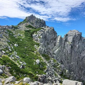
Nao70 had expected the hammerhead-shaped rock at Chōsu no Atama to be demanding, but reported that other sections were difficult too. After climbing the rock without leaving their backpack behind, the hiker felt it might have been better to set the pack down. The chimney section was also harder than expected. Yakyūsan, which the hiker described as Myōgi’s highest peak, proved tougher than anticipated.