This account was published on November 12, 2026; it does not specify the date of the hike.
A group of four hiked Minobusan, starting from Nakamachi parking area at about 7:00 a.m. The recorded route covered 12.9 km, with 989 m of ascent and 990 m of descent. Total elapsed time was 7 hours 57 minutes, including 2 hours 30 minutes of breaks.
The group walked through the temple town and entered Kuonji through its large gate. After climbing the steep steps, they passed the temple’s five-story pagoda and main hall. Behind the hall, they chose the walking route toward the summit rather than the ropeway.
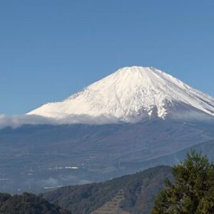
The writer noted halls along the route, covered rest areas, pit toilets and a water vending machine. Beyond Taikobō, the paved section ended, but the route remained wide and, in the writer’s experience, easy to walk. There was also a viewpoint overlooking Mount Fuji.
At the summit, the group found the inner sanctuary, a ropeway station, a shop and dining area, and viewpoints. They descended by a different, broad route, passing temple lodging at a mountain pass. The writer described the descent as uneventful; that experience is not a guarantee of trail conditions for other visitors.
Source: yamap.com (originally published 2026-11-12 09:17 UTC+8)