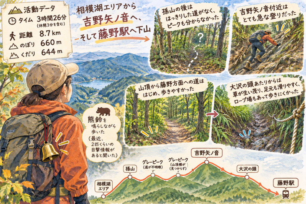
A hiking log published on November 17, 2026, describes a route from the Sagamiko area toward Yoshino Ya no Oto, with a descent toward Fujino Station. The recorded walk covered 8.7 km in 3 hours 26 minutes, including 3 minutes of rest, with 660 m of ascent and 644 m of descent. The log does not specify the date of the hike.
The hiker reversed their original route plan and chose to descend toward Fujino after reaching the summit. They reported finding no clear path after Magoyama and could not locate the summit marker at a second off-trail peak. Near Yoshino Ya no Oto, they described a very steep climb.
The path toward Fujino initially felt easy to walk, according to the hiker. Around Ōsawa no Atama, however, they encountered overgrown vegetation, slippery footing and a rope-assisted section. The hiker also said they rang a bear bell because they had heard that roughly two bears had been seen recently; the log does not verify that report.